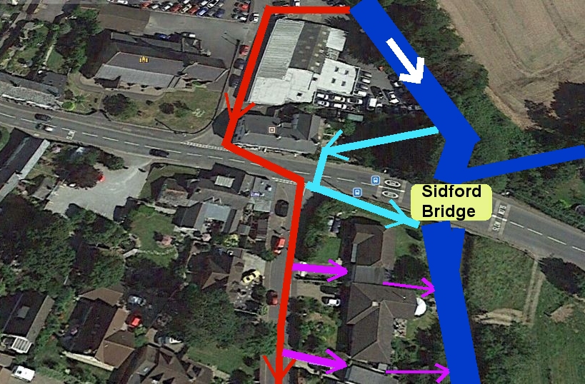
 |
Unlike the flood of 7 July
2012, this one occurred at night - when I was at a dance in Exeter.
These photographs are mostly from the day
after - 25 November 2012.
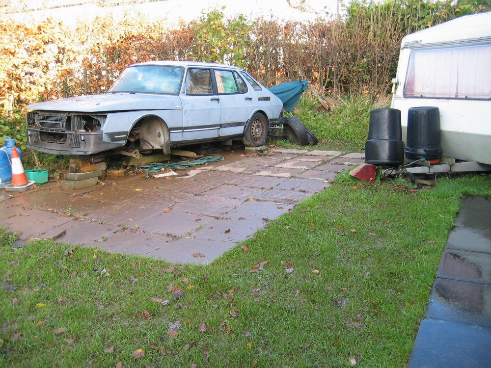
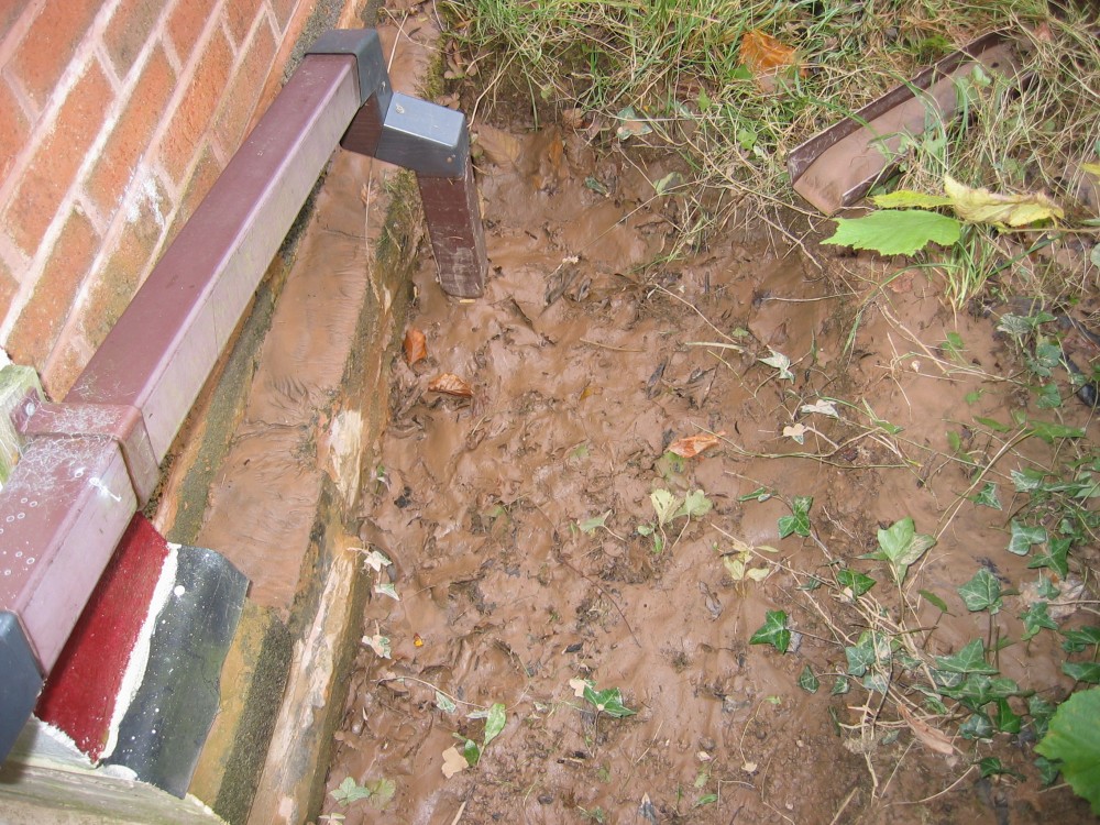
Water had overtopped my driveway and
completely inundated the front garden.
Piles of twigs can be seen against the front
of the caravan. The paving slabs are covered in about 6 to 10mm of mud.
The old car is a 1985 Saab 900i. I bought it
in 1988 and ran it until 2007 when the gearbox finally expired after 250,000 miles.
After being cannibalised for parts, it was
finally scrapped in 2018. |
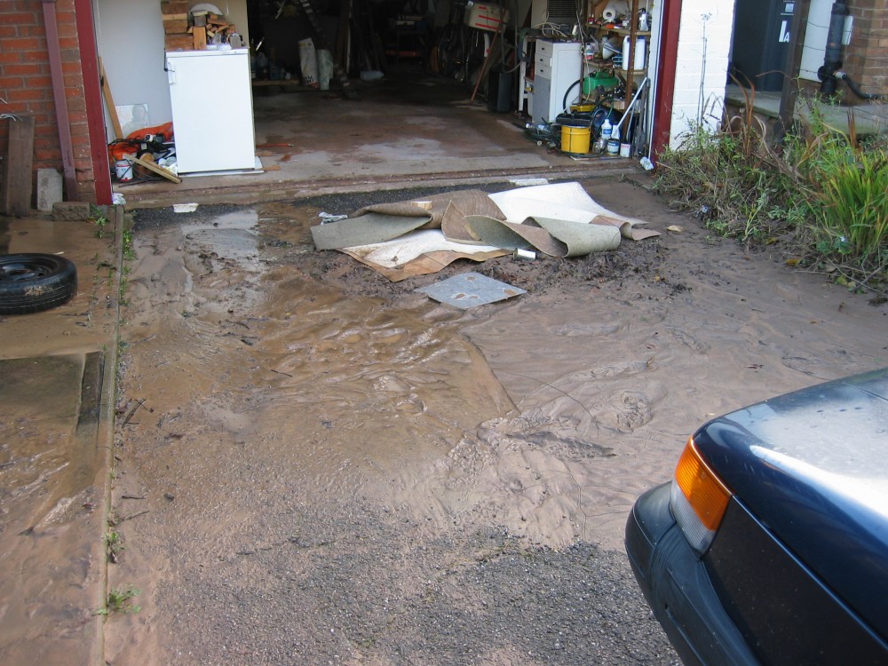 |
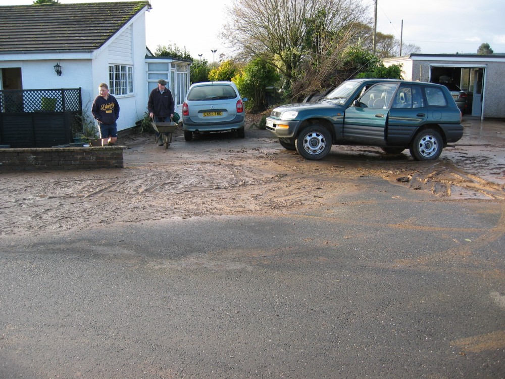
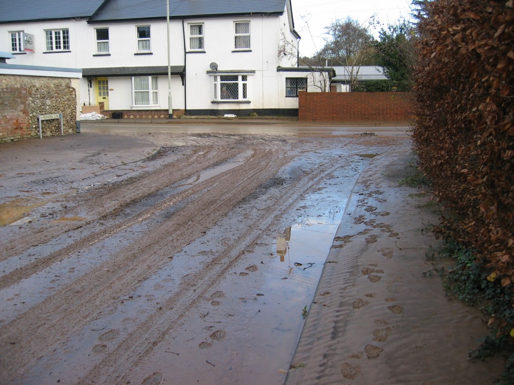
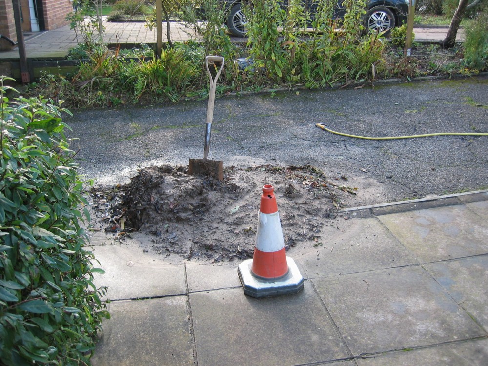
The driveway was a complete
mess with large accumulations of mud and piles of twigs and leaves. The single 110mm
surface water drain was completely blocked.
The garage carpets were sodden.
Electrical power had become disconnected
because the freezer in the garage had been under a few mm of water - just enough to
inundate an electrical junction box.
The peak flood was at around midnight. By
the time I arrived home at 1am the water had drained sufficiently to permit power to be
restored - the earth leakage trip now sensing that all circuits were again safe. |
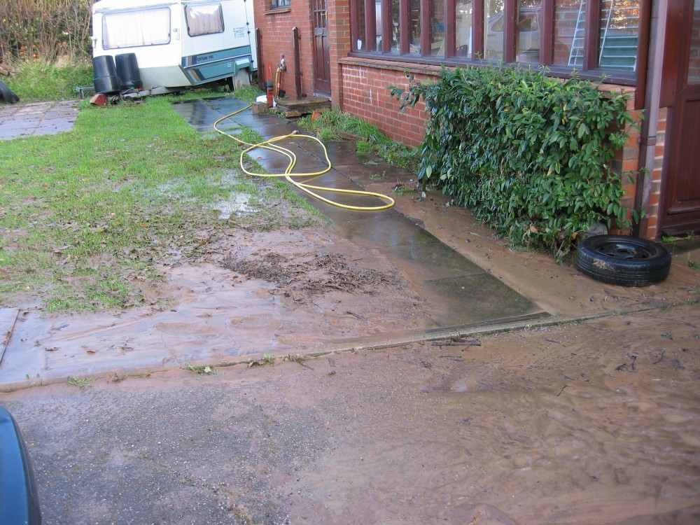 |
All of the pathway had been
covered in mud - the first job was to hose down a walkway to the front door.
This whole area had been a mass of swirling
water - up to 300mm deep.
Just a pity I wasn't home to see it!
My bungalow is permanently
protected to the height of the conservatory windows, with the exception of
the front entrance door, where a flood board can be bolted into place within
a few minutes to give the last 300mm of protection.
Even on 24 November 2012, the
flood water did not reach the level of the airbricks at the front of the
bungalow, and would have needed to be about 500mm higher to gain entry into
the bungalow itself.
If such an extreme event were to occur,
half of the older buildings in the lower areas of Sidford would be
inundated. The Sid exhibits a rapid rise of flood water level - but also a
rapid fall. To
the untrained eye my bungalow might appear to be at high risk of flood
damage because of its location. However, because of its design (with floor
levels 600mm above the flood plain required by Building Regulations at the
time of its construction) and the flood barriers that are in place, it is
one of the buildings in this area of Sidford that is least likely to suffer
significant damage.
Older buildings, with ground floor levels
close to the natural ground level, are at far greater risk. Yet few
residents take the matter seriously! |
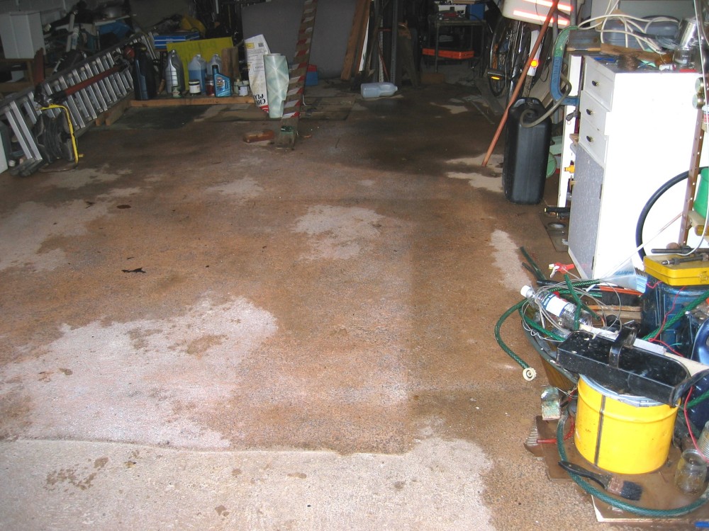 |
With carpets removed it was
clear that half to 2/3 of the garage floor was covered with a thin layer of silt.
When I built the garage in
around 2000, I had
the floor laid on a slight slope so it could easily be washed out - a sound idea.
An even better idea would have been not to
store so many things on it. |
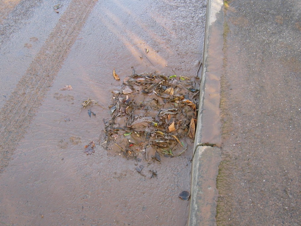 |
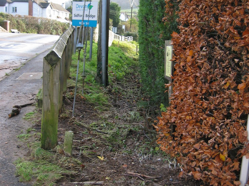
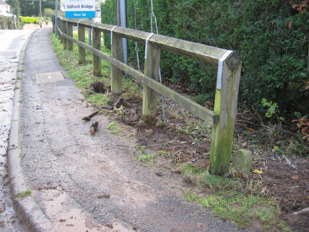
Residents need to learn the
importance of clearing road drains of twigs and leaves.
Whilst the road does flood from time to
time, the quantities of water involved are often small and could probably be accommodated,
at least in part, by the drains, provided these were kept clear.
On the morning after the flood, they were
all blocked.
Clearing all drains would be of most benefit
to householders at the southern end of the Close - and it was these who suffered the most,
owing to their houses having been constructed before Building Regulations required that
floor levels be raised 600mm above flood plains. |
 |
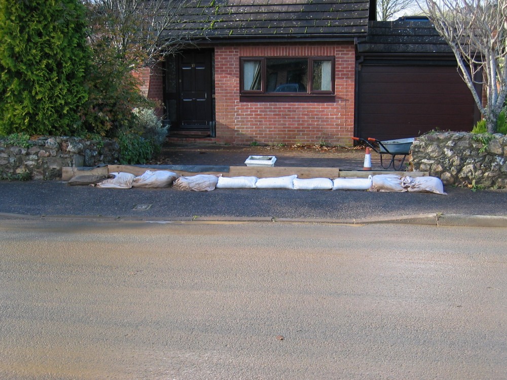
This house at the end of
Packhorse Close was sold to its new owners earlier in 2012.
As of 2016 further fencing and walls had been built and the garden can be protected by
using a few sandbags across the driveway.
This action would of course increase the risks for the few householders who do not have
protection measures either in place or easy to hand. |
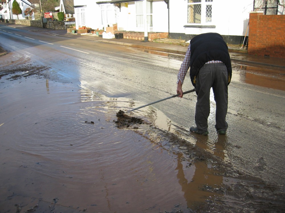 |
Too little, too late.
This is the main road drain at the junction
of Packhorse Close to the main A3052.
It is at the lowest point of the road in
this area. When the Sid overtops its banks to the north of the bridge there can be up to
400mm of flood water here.
In the floods of July 2012 this drain stayed
clear, but in November's floods the river water brought with it far more twigs and leaves.
These blocked all the local road drains.
The mass of swirling water around this drain
in the July 2012 floods is shown on an earlier webpage. |
 |
The visibility splay beside
the A3052 was deep in water and debris - the first time this has happened in over 20
years, and according to local people, in well over 30 years.
This may not have happened at all (or have
been less severe) if the river bed level had been much lower before the deluge of 24
November. |
 |
The ferocity of the water
was so great it started to dig at the foundations of this roadside fence. |
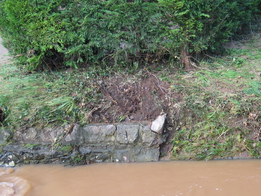 |
The river also made some
attempt to gouge out part of this defensive wall. The vegetation may grow back and knit
the area together before the next flood. |
 |
The aftermath -
scenes like this occurred twice in 2012.
As of
early 2025 no further floods on this scale have
occurred. |
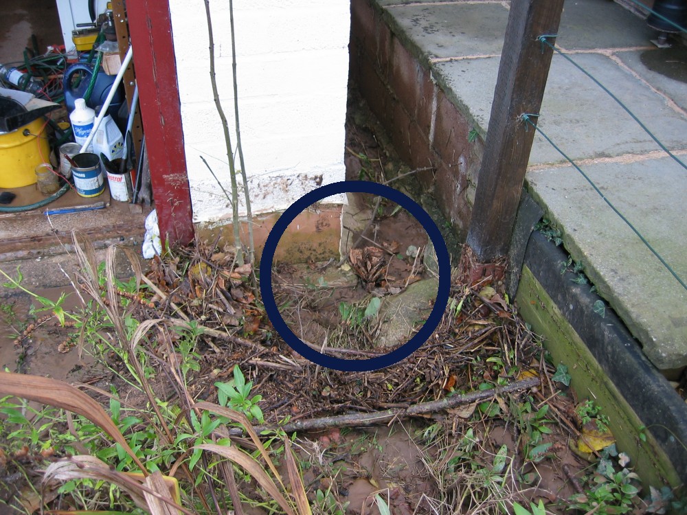 |
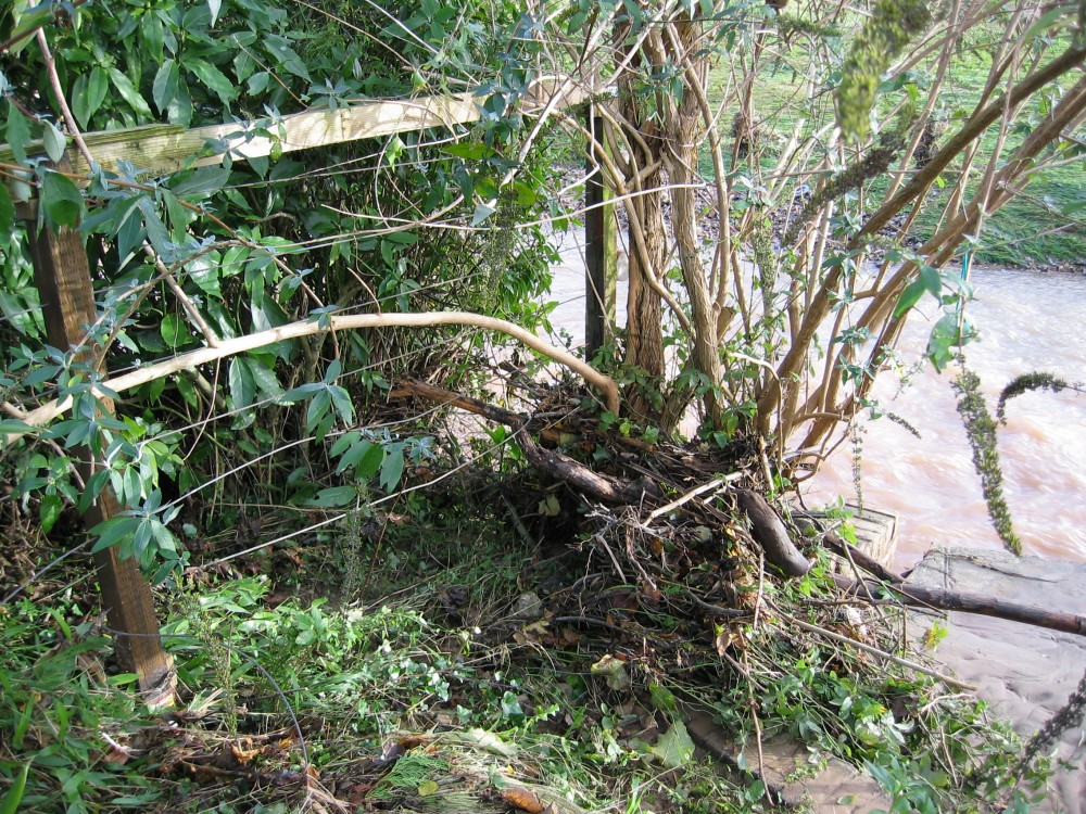
This is the critical flood
relief channel down the side of my garage. It is the only escape route for water that
overtops the head of the driveway (by the road) once the single surface water drain
becomes blocked.
However, on this occasion (and in my
absence) the flood water picked up a spare tyre and wheel that had been propped against
the conservatory door and wedged it in the location shown. Twigs and leaves then built up
both around this and around the self-seeded ash sapling.
But in November 2012 worse was to come. |
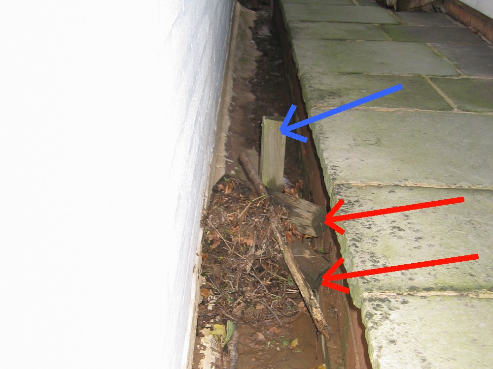 |
The flood water also picked
up two wooden blocks (shown red) that had been left on my driveway and wedged them firmly
against an old fence post that I had left in place to mark the line of the original
boundary fence, before I built my garage.
The resulting log-jam caused a build up of
other debris and the relief channel became severely restricted. Flood water in channels
such as this is conveyed by only a small pressure head - often only a few cm of water -
and even slight impediments to flow may not be swept aside.
This is the principal lesson for the future
- ensure that this flood relief channel stays clear.
The post has since been cut down. |
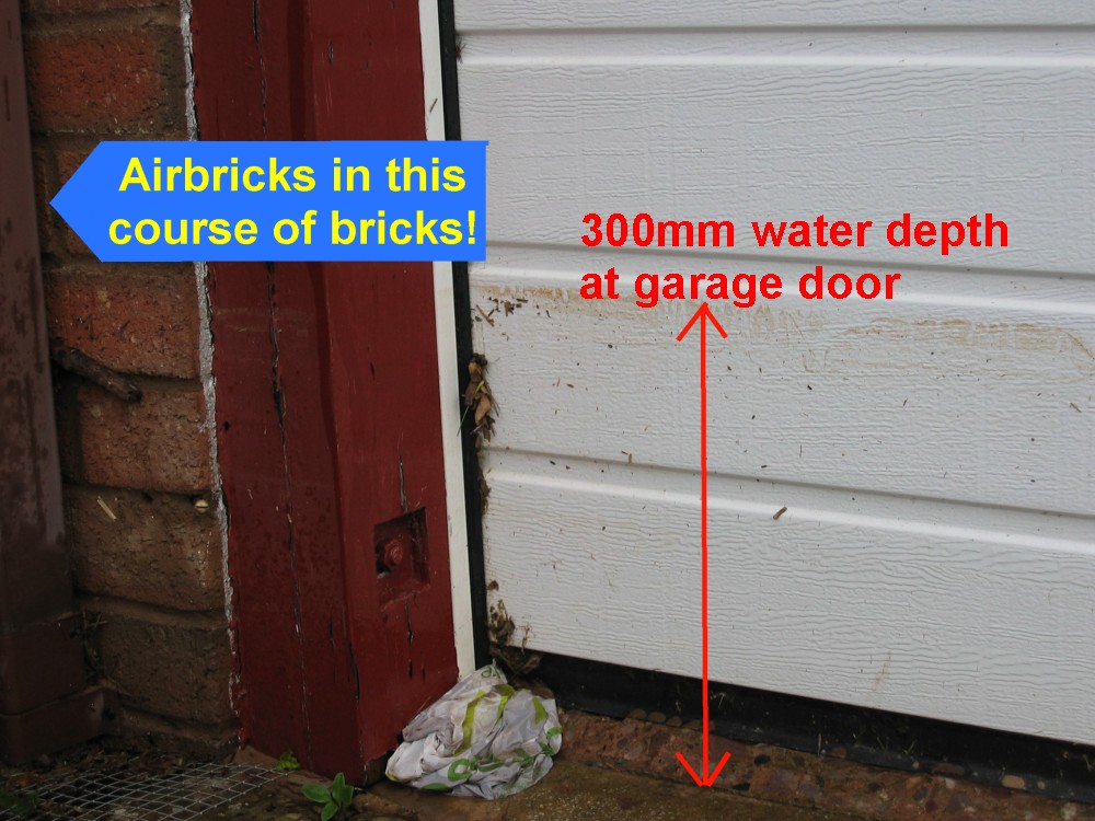 |
Thus, more water than should
have collected on the driveway built up to a 300mm depth, testing both the conservatory
door and the high quality (German) garage door - and both held very well. Despite 300mm of water against it, the maximum depth
of water in the garage at the front end was 10mm, tapering to zero about half way to the
rear. All electrical sockets are a metre above floor level, and the
plasterboard does not extend to floor level - thus it cannot be damaged by a
small depth of flood water. I built this garage with floods in mind!
The river level at the back of the garage
was exactly to the threshold of the rear door - which in 2012 was overdue for additional flood
defences. These have since been completed.
All my airbricks are permanently protected
to 1000mm above this height of flood.
When water reaches the level
shown here, it starts to flow across the front lawn and down the north side
of my house. Thus, this level should rarely if ever be much exceeded -
whilst the level at the front of the dwelling might much increase, that at
the rear is governed essentially by the floodplain of the Sid, and a massive
increase in flow volume would result in only a modest increase in the level.
Despite the river being at the
rear of my home, all the flood risks (and defences) are at the front!
|
 |
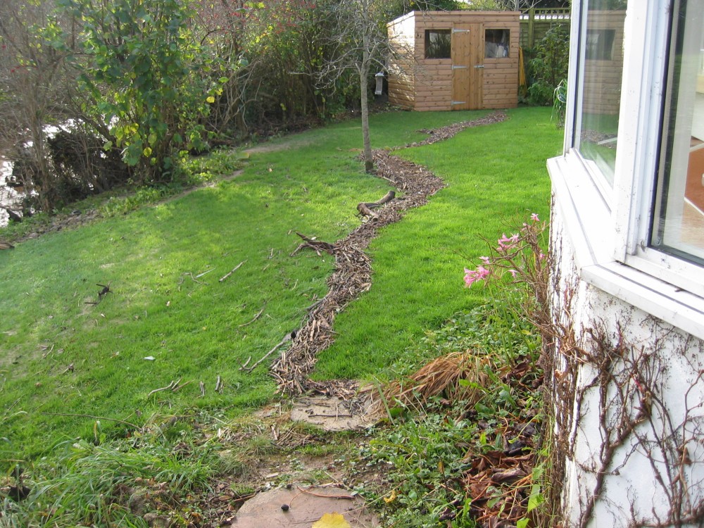
Large areas of garden were
covered in up to 120mm of silt.
The water flow patterns were quite different
from those in July 2012 because the flood water flowed not only through the arches of the
bridge and over the garden but quite forcibly down the side and through the hedge.
Much of the extra destruction may have been
owing to the river bed having been so high immediately before the downpours of 24
November.
Thus, the EA need to be especially aware of
the importance of dredging excess material from the riverbed at Sidford whenever an
opportunity occurs.
The excess depth after 24 November was
around 600mm. The area was subsequently dredged on 17/18 December 2012. |
 |
The drain from my garage
roof goes into a single 110mm pipe - the arrangement works well but is here covered in
50mm of silt and leaves.
The working of the drain to discharge water
from the roof was unaffected - it just no longer worked as a surface water drain. But such
a function is not required in this location, so the mud didn't really matter. |
 |
The tide line of twigs on my
neighbour's pristine lawn is witness to the peak level of the river - they were away at
the time and so missed all the excitement!
Their new garden shed survived but the floor
was covered in mud. |
 |
This flood brought down an
unusually large quantity of twigs and leaves - naturally enough for autumn. |
 |
The door of my conservatory
is a first line of defence against floods on the driveway. I built the whole conservatory
to be especially strong and waterproof. With a little extra buttressing the door easily
held against 300mm of water.
Probably less than a litre of water seeped
through - but even if the door seals gave way under the force of a much greater depth of
water, the house is further protected by very strong flood boards to the height of the
conservatory windows.
Such a level might be reached in a 1 in
5000
year flood - and half of Sidford would then be underwater. |
 |
Part of the mud collected
from the front driveway.
This was dumped in my front hedge to help
boost defences for next time.
During 'lockdown' in the Covid pandemic I
dug up and replaced the old tarmac driveway with a new concrete one - and
doing all the work myself.
My new driveway has 150mm of compacted
subbase and 175mm of high strength concrete. The drainage in front of the
garage door was much improved, and now has a linear drain across its full
width. I also
built a flood defence wall between my garden and my neighbours driveway - to
prevent floodwater from their driveway flowing onto my land. This, and my
new defences for across the top of my own driveway, will be shown on a
subsequent webpage. |
 |
Neighbours opposite deployed
conventional defences - I could do the same but this would have adverse consequences for
the rest of the Close because so much water flows naturally over my garden back to the
river - or at least it did before I built my double garage (with full planning
permission!).
With defences of this type being used by an
increasing number of residents, keeping road drains clear will be even more important to
help limit the amount of water that reaches the bungalows at the end of the road. |
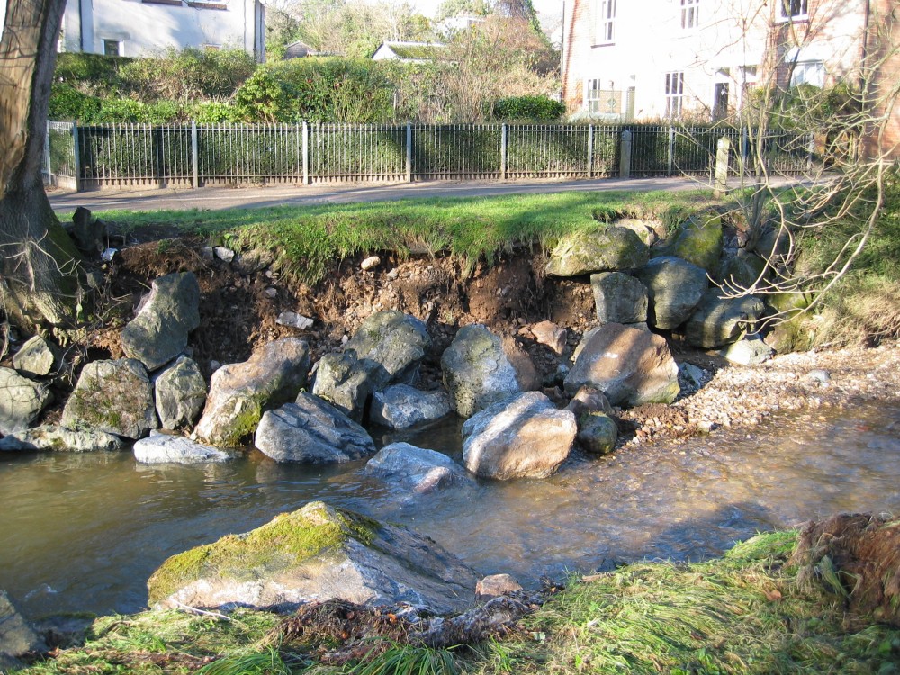 |
Downstream of Sidford the Sid
flows for a while across its natural floodplain and through largely open country - and
well away from houses. Where footpaths cross or abut the river, some attempt has to be
made to limit its destructive behaviour. As it nears the sea, the Sid once again needs to be managed more
comprehensively in order to limit damage to property.
These boulders were part of the defences at
the bottom of Sid Park Road. Similar damage occurred nearby both in July 2012 and in
November 2012.
As of 2025 no repairs have been undertaken,
probably owing to cutbacks in EA funding. |
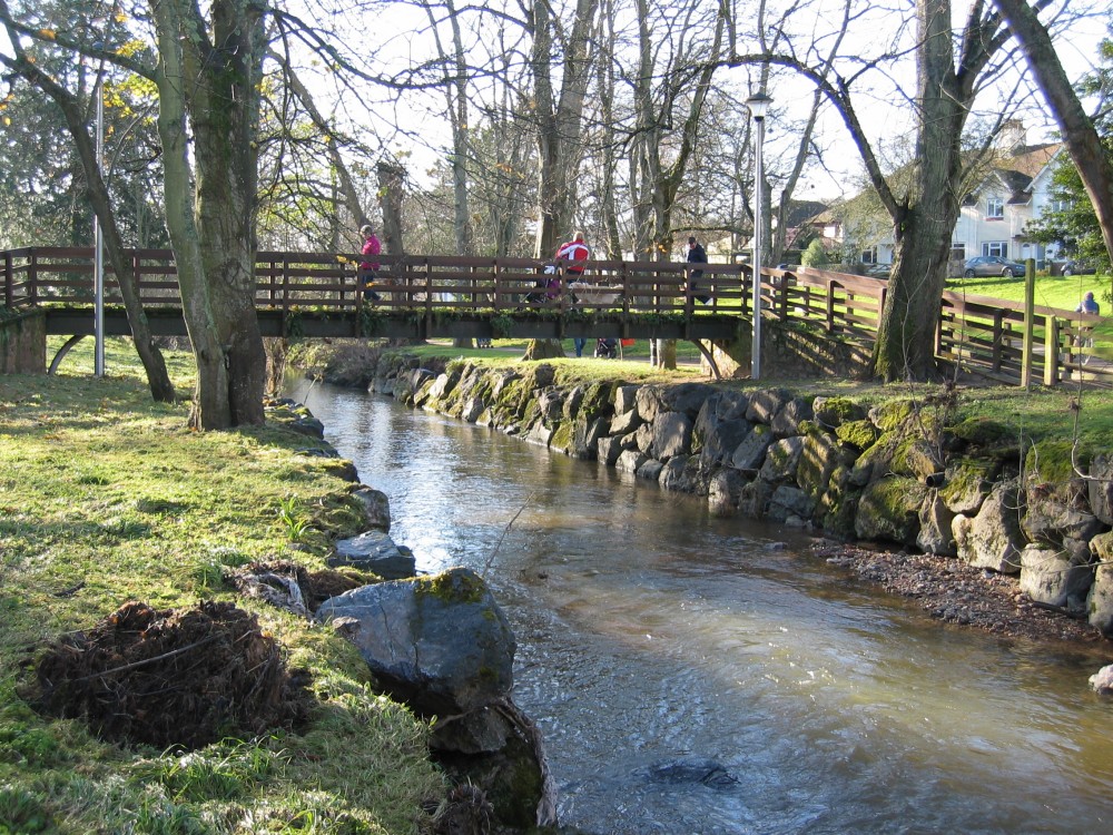 |
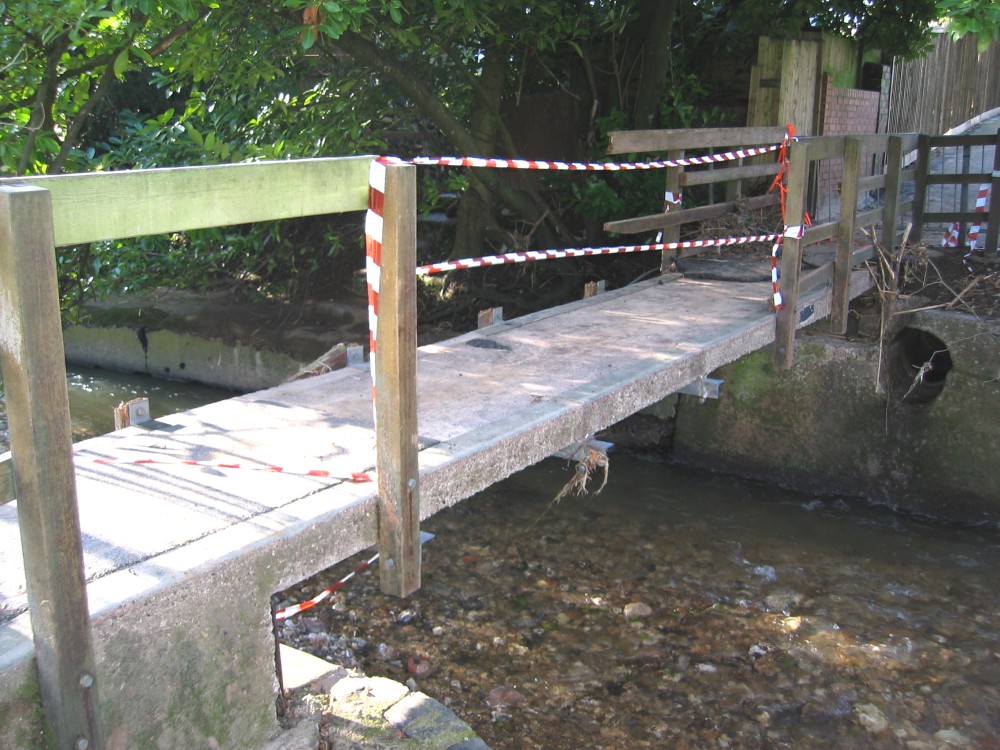
This is the footbridge at the
bottom of Sid Park Road, Sidmouth. A
local resident told me that in nearly 30 years he has never seen the water so high as on
the night of 24 November 2012. A layer of silt on the bridge surface bears witness to his
assertion that it was just lapping over the foot way. Structurally the bridge survived
very well.
This photo was taken a week after the
November flood. As happened in July 2012 also, The Byes parkland returned to normal very
quickly. The only remaining signs were a few broken bridge handrails, areas of silt, some
displaced stones and boulders and piles of leaves and twigs. |
 |
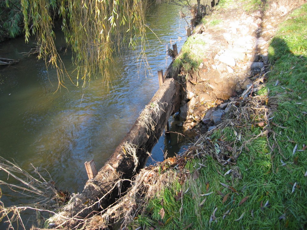
Lower down the Sid, the old
footbridge at Lawn Vista suffered considerable damage. In fairness, it had already been repaired (patched
up) several times and much of the wood may have been half rotten.
The flood therefore merely brought forward
the date for complete reinstatement of the railings and decking surface. |
 |
Minor damage to embankments
could be seen along the last mile of the Sid. |
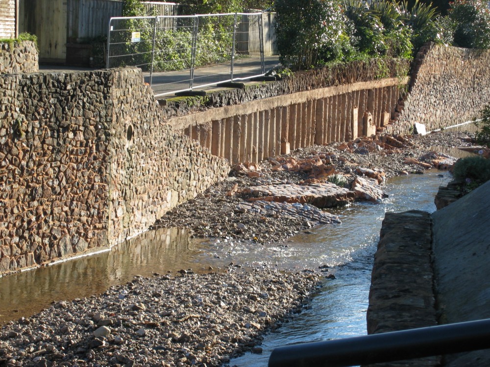 |
In the July floods, a large
brick wall just upstream of the ford was demolished by the force of water. In November's flood, a section of wall
downstream of the Mill St footbridge was demolished.
The damage in this case looks to be as much
decorative as it is structural.
It was later rebuilt. |
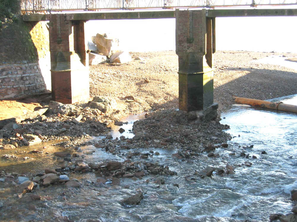 |
The pillars of Alma Bridge over
the river Sid as it nears the open sea suffered further damage. Several 'protest groups' in Sidmouth
saw saving
Alma Bridge as supremely important. They argued it is a 'lifeline' for residents living on
the east side of town.
In reality it was as much an icon as a useful
asset once that the coastal footpath had been diverted away from the crumbling and
collapsing cliffs nearby.
As of 2016 it was accepted that the bridge
could not be saved and a new crossing further upstream was designed. It was
opened in c 2023 (link to follow). |
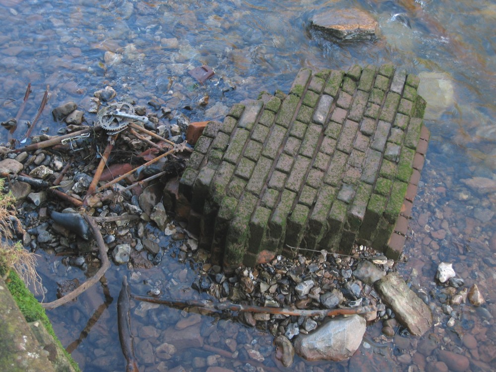 |
This is probably a section of
a garden wall that collapsed into the Sid in July - it has now made progress almost to
the open sea. At a rough
estimate it comprises 100 bricks and mortar with some backing concrete. It is probably
made from dense solid bricks so each may weigh about 3 kilo with mortar - so the total
weight may be approaching half a tonne.
Bricks are not actually very dense -
typically 2000kg/cu.m (kilo per cubic metre) about twice the density of water. Granite
boulders, often used for flood defences have a density of around 2700 kg/cu.m. |
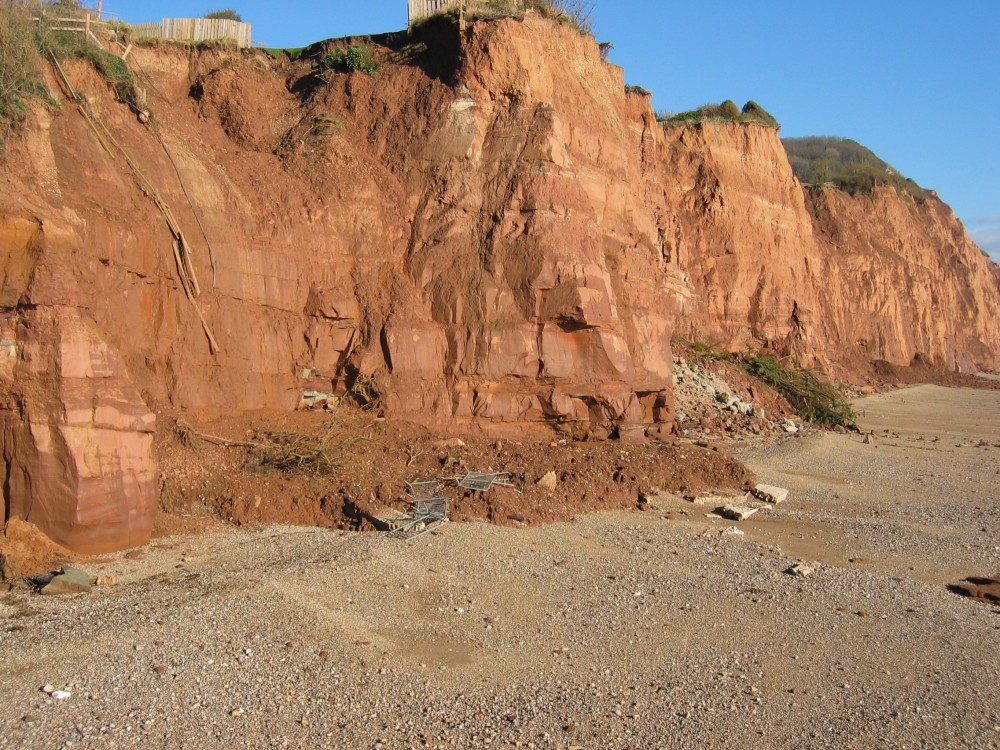 |
In the same week, there were
further large cliff falls to the east of Sidmouth. The cliffs here consist of variously
friable and easily eroded soft material. Whilst much is made of the need for 'sea defences' to protect
these cliffs, much of the erosion and collapse of large sections of cliff is caused
primarily by rain water.
Even if sea defences were installed the
cliff face would continue to retreat until a stable angle was reached - and by that time
the houses on Cliff Road would have lost maybe half or more of their remaining gardens.
Even then, erosion would continue. It may be only a matter of time before some or all of
these substantial houses become worthless.
The same might be true today for many low
lying houses in Sidmouth had not the river Sid been comprehensively 'managed and tamed'
over the last 50 years.
|
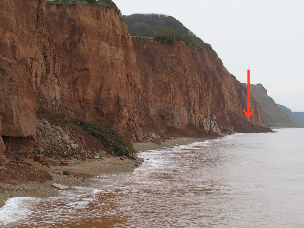 |
About a week after the floods,
there was a large cliff-fall about 300 metres to the east. In this photo, the tree that
fell down earlier can still be seen. Winter storms and tides will wash all the loose
material away.
A local councillor had the idea of dumping a lot of the material dredged from the Sid
around the base of the cliffs near Alma Bridge to help prevent erosion.
The material was duly delivered to the end of the Esplanade by the EA - and was washed
out to sea before it could even be put into place. It would have lasted maybe a few days
or weeks!
Problems along this part of the coast became more
severe when EDDC replaced the old wooden groynes that had served well to protect Sidmouth
beach. The new rock 'islands' altered wave and water flow patterns to the east - and
all the beach shingle disappeared. Predictions that this would happen had been discounted
by EDDC. |