FARWAY VILLAGE HALL, East Devon
Postcode EX24 6DQ.
SAT NAV: N50.45.11 W3.09.30
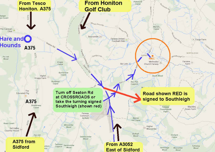
One of the easiest routes to FARWAY Village Hall is to start from the Hare and Hounds pub on the A375 (= Putts Corner junction, signed to Seaton and Farway). This major (and sometimes lethal) junction on the A375 is midway between Sidford and Honiton. Then turn left at a CROSSROADS after 1.9 miles into Ball Lane. Ball Lane is a direct route (only 1.3 miles from the crossroads to the hall) but steep and narrow in places. There are two maps and a photograph below - take your pick!
If you 'cut the corner' and take the road signed to Southleigh (shown in red and approx 1.7 miles from Hare and Hounds) turn left after 300 metres back onto the blue route (Ball Lane).
From Seaton or Sidford a direct route is possible, see below. The turning off the Seaton Road at the airstrip is a CROSS ROADS but (as of Google maps in 2009) was not signed to anywhere!) There are several other routes; those shown use 'main roads' as far as possible.
From Honiton Golf Club, use Farway Common Road, turning left into Money Acre Rd if desired (signed to Farway and Northleigh).
Minor roads can be badly maintained without signposts and the whole area is prone to localised fog. In bad weather the Money Acre Rd route may be safest.
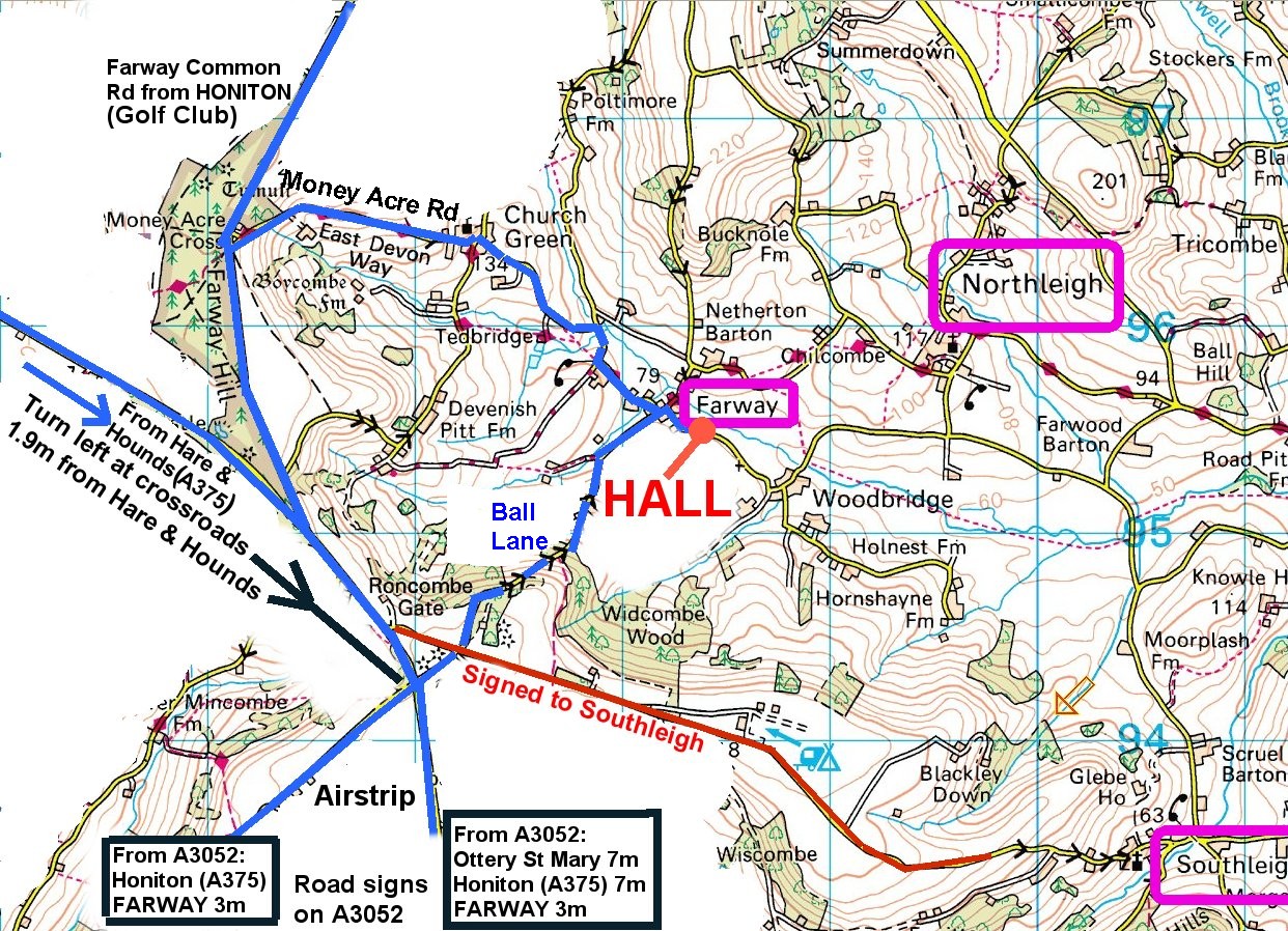
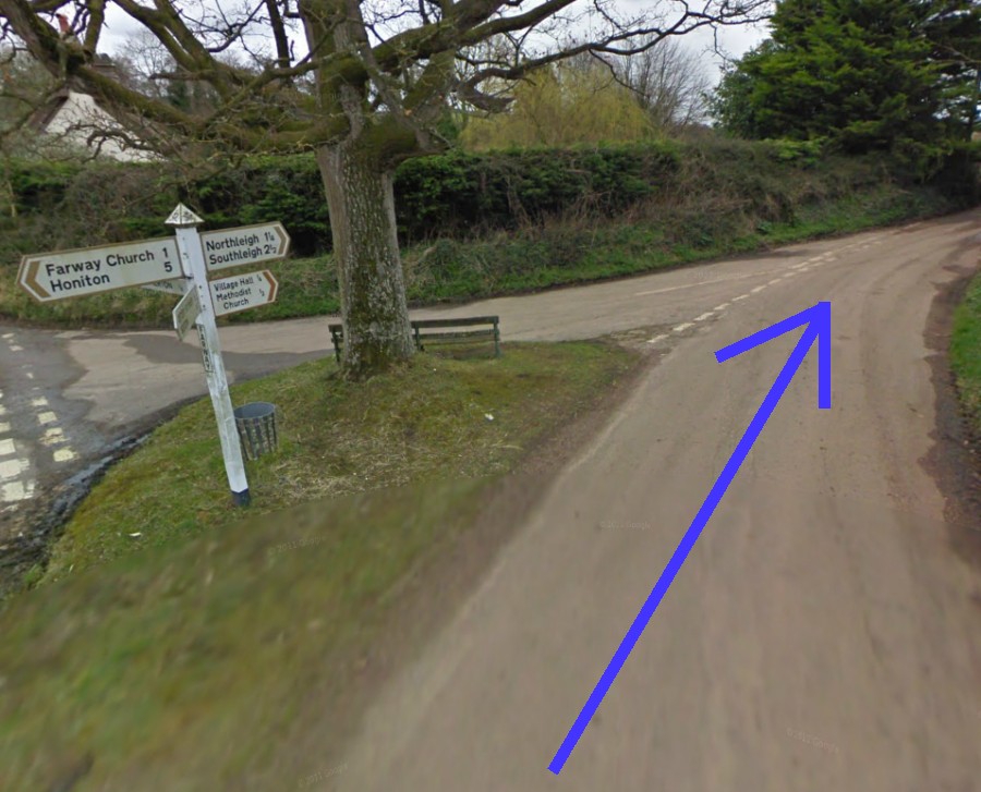
As you approach Farway along the blue route the road bends to the right and is signed Northleigh and Southleigh
(also to Village hall 1/4 mile and Methodist Church 1/2 mile)