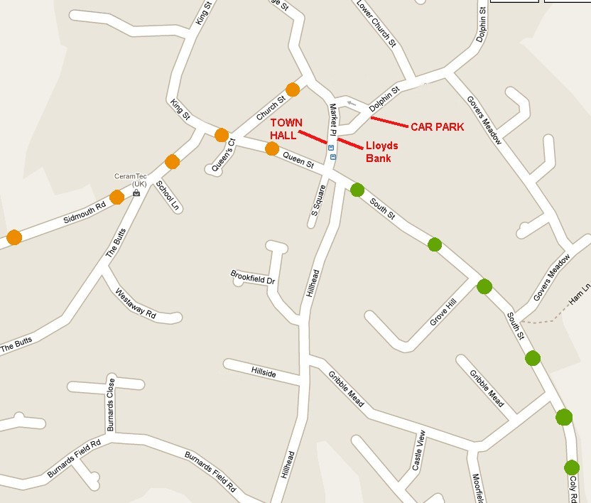
Recommended routes to the Town Hall, COLYTON, East Devon. EX24 6JR.
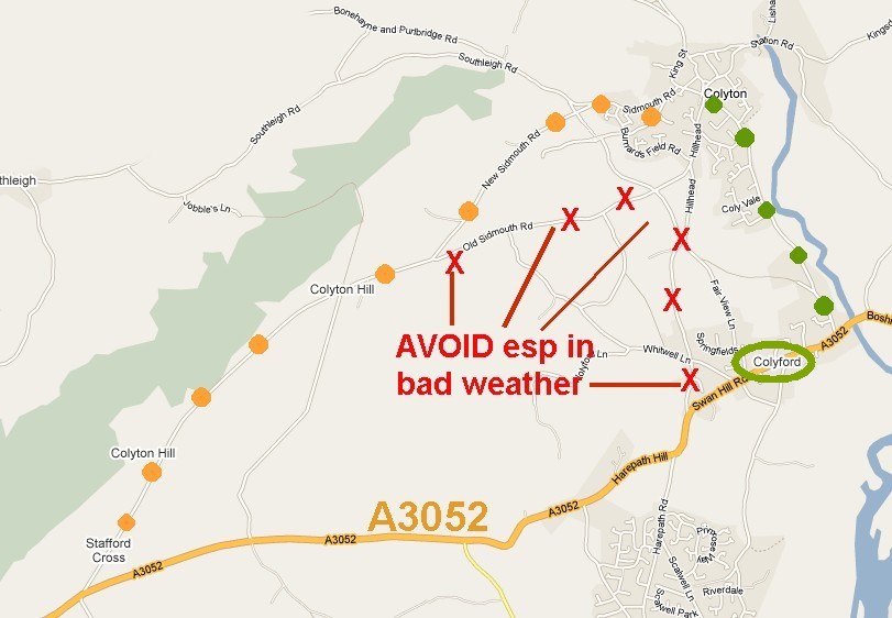
In bad weather, you are recommended only to use the route shown by green dots. This is along COLY ROAD (becomes South St) from the A3052 near the bridge in Colyford. Compared to other routes it is quite flat: you do the steep hill climbs and descents along the A3052 - which should be gritted.
Sat Nav devices may lead you down all manner of tiny roads - it is better to set an exact destination along the A3052 and then simply follow Coly Road/South Street into town. The Sat Nav coordinates for the A3052 turnoff are N50:43:42 W3:03:35.
The route from Stafford Cross (orange dots) is OK most of the year but not recommended in icy weather: it is steep, narrow and undulating. The edges of the road are often in poor condition.
The Town Hall is almost opposite Lloyds bank. There is a car park on Dolphin Street. Postcode = EX24 6JS
The venue Sat Nav coordinates are N50:44:26 and W3:04:13 but see note above about using Sat Navs!